
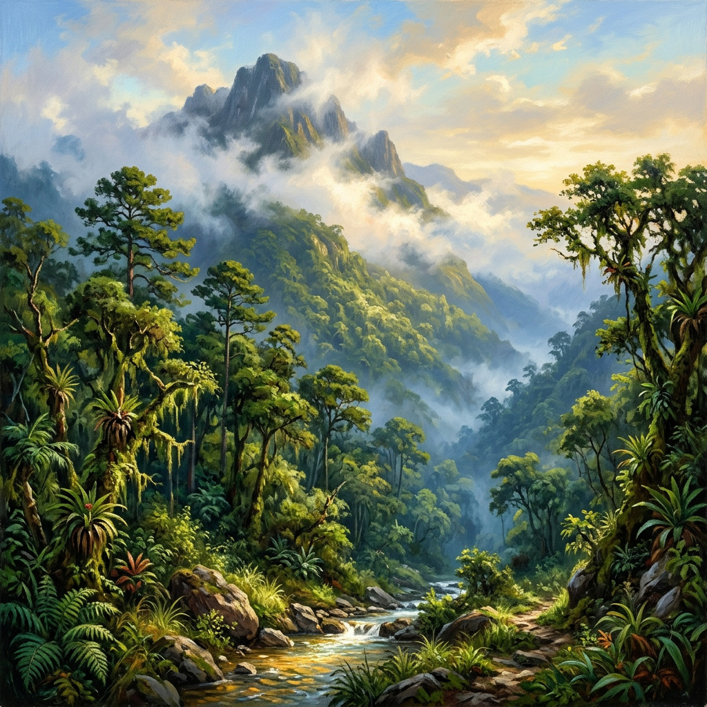
Before dawn on the southern peninsula, the clouds come up from the sea and stop at the mountain. They pour over the ridges of the Massif de la Hotte, settle into the ravines, and wrap the summit of Pic Macaya so completely that for hours the peak does not exist at all. Then the sun burns through, and what it reveals is something most Haitians have never seen with their own eyes: an old forest, dripping with moss and orchids, rising almost two and a half kilometers above the Caribbean. It is one of the last places in Haiti that still looks the way the whole island once did.

A Mountain at the End of the Peninsula
Pic Macaya stands 2,347 meters (about 7,700 feet) high, the second-highest summit in Haiti after Pic la Selle. It sits deep in the Massif de la Hotte, the rugged spine of the Tiburon Peninsula, roughly 36 kilometers northwest of Les Cayes and nearly 200 kilometers west of Port-au-Prince. Getting there is still an expedition: a rough road to the foothills, then hours of climbing on foot along paths cut by farmers, charcoal makers, and mules.
The mountain’s isolation is the reason it survived. Biologists believe the southern peninsula was once its own island, separated from the rest of Hispaniola by sea. Over millions of years, plants and animals stranded there evolved into species found nowhere else on Earth. When the land masses joined, the mountains kept their secrets. Even today, biologists describe the region less as part of Hispaniola than as a world unto itself.
In 1983, the Haitian state recognized what it had and created the Parc National Naturel Macaya, a protected area that stretches across three departments: the Sud, the Grand’Anse, and the Nippes. It was among the first national parks in the country, and it remains the most important.
Inside the Cloud Forest
Climb high enough on Macaya and the air turns cool and wet. The trees grow shorter and more twisted, their branches upholstered in moss, ferns, and bromeliads. Hispaniolan pines stand on the ridges; below them, in the damp folds of the mountain, broadleaf forest closes overhead. Rain here can reach some 4,000 millimeters a year, and the clouds themselves deliver water, condensing on leaves and dripping steadily into the soil.
That water does not stay on the mountain. The park feeds more than seven rivers that run down to the plains of the south, watering the fields around Les Cayes and the coastal towns beyond. Peasant farmers who have never set foot on the summit drink from it every day. In a country where deforestation has turned many rivers into flash floods in the rainy season and dry beds the rest of the year, Macaya’s forest works as a sponge, releasing water slowly and holding the soil in place.
The botanical wealth is staggering. Researchers have recorded 141 species of orchids in the park, 38 of them endemic, alongside hundreds of other flowering plants, many found only on these slopes. Some orchids are no bigger than a fingernail; others hang in sprays from branches high above the trail. Naturalists who come for a week often leave with specimens no one has formally described.
The Frogs That Came Back From the Dead
Macaya’s true celebrities are small, brown, and mostly heard rather than seen. The Massif de la Hotte holds one of the densest concentrations of endemic amphibians anywhere in the world, most of them tiny frogs of the genus Eleutherodactylus. Unlike most frogs, they skip the tadpole stage entirely: eggs laid in moss or leaf litter hatch directly into miniature adults, which lets them live far from open water in the damp of the cloud forest.
Some of these species live on a single mountain. The Macaya breast-spot frog, Eleutherodactylus thorectes, is known only from the high slopes of Pic Macaya and neighboring Pic Formon, between about 1,700 and 2,340 meters. It is among the smallest frogs on Earth, small enough to sit on a coin.
For years, scientists feared many of these frogs were gone. Then, in October 2010, only months after the earthquake that devastated Port-au-Prince, an expedition led by Robin Moore of Conservation International and the herpetologist S. Blair Hedges climbed into the Massif de la Hotte to look for them. They worked at night, following calls through the wet forest with headlamps. They came out with good news Haiti badly needed that year: six frog species that had not been seen for nearly two decades were still alive, among them the La Hotte glanded frog, which had gone unrecorded since 1991.

Survivors of an Older Hispaniola
The frogs are not the only survivors. The forests around Macaya shelter the Hispaniolan solenodon, a shuffling, long-snouted mammal whose lineage reaches back to the age of the dinosaurs. It is one of the very few mammals in the world with a venomous bite, delivered through grooved lower teeth. Solenodons were here long before any human arrived on the island, and in Haiti they now hold on almost entirely in these southern mountains.
Overhead, on the steep cliffs around the massif, the black-capped petrel, known across the island as the diablotin, returns at night to nest in burrows. These seabirds spend their days far out over the Atlantic and come back to land only under cover of darkness, calling eerily as they circle the ridges. The area called Aux Diablotins, named for them, is one of the most important nesting grounds for the species anywhere.
Together, these creatures are a living record of Hispaniola before Columbus, before the plantations, before the island was cleared. When Haitians speak of the Taíno name for their land, Ayiti, “land of high mountains,” it is landscapes like Macaya they are describing.
A Forest on the Edge
The story of Macaya is also a warning. In 2018, a team of researchers from Temple University, Oregon State University, the US Forest Service, and Société Audubon Haïti published a study in the Proceedings of the National Academy of Sciences that measured how much primary forest Haiti had left. The answer was devastating: just 0.32 percent of the country in 2016, down from 4.4 percent in 1988. Forty-two of Haiti’s fifty largest mountains had lost all of their primary forest. At the rate they measured, the authors warned, the rest could be gone within two decades.
The pressures are not mysterious. Families in the foothills cut trees to make charcoal, the fuel that still cooks most of Haiti’s meals, and clear slopes to plant beans, yams, and corn. Few have other options. A park boundary drawn on a map in 1983 has never come with enough rangers, money, or alternatives to stop people from doing what they must to survive. Hurricane Matthew, which tore across the Grand’Anse and the south in October 2016, stripped forests and farms alike and deepened the poverty that drives the cutting.
Who Is Fighting for Macaya
Yet Macaya is not a lost cause, and Haitians are leading the fight to save it. Société Audubon Haïti has spent years surveying the birds and frogs of the south and training local guides. In 2019, working with the Haiti National Trust and international partners, conservationists established Haiti’s first private nature reserve on Grand Bois, another peak in the Massif de la Hotte, protecting rare species such as Ekman’s magnolia and the Tiburon stream frog. Environmental programs supported by the United Nations have worked with communities around Macaya on tree nurseries, agroforestry, and new sources of income, so that protecting the forest becomes a living rather than a sacrifice.
The lesson the people of the south keep repeating is simple: a forest cannot be saved against the people who live around it, only with them. As a Kreyòl phrase puts it plainly: Pye bwa se lavi, trees are life. On the slopes of Macaya, that is not a slogan. It is the water in the river, the soil in the garden, and the frog calling in the dark.
Pic Macaya is a reminder that the Haiti of the history books, the Ayiti of high mountains, is not only a memory. It still exists, hidden in the clouds above the southern peninsula, sheltering creatures older than the nation itself and feeding the rivers that keep the south alive. Protecting it is part of the same long struggle for dignity and self-determination that runs through every chapter of Haiti’s story. Here at HaitiPAM, we will keep telling the stories of the places that make Haiti what it is, because a country that knows its mountains is a country that can fight for them.
Leave a Reply